
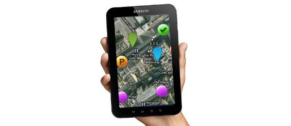
A GPS For The Scavenger Hunt
I am pretty sure that all teachers, and I am one of them, have already used bi-dimensional maps whether they were those fold-up maps, illustrations that were in textbooks or even a simple map drawing on the board. But, imagine the reaction of a student whose daily routine is all about iPads, Playstations and smartphones. Such map would be really boring to this kid.
That’s exactly when someone might say “map apps are also bi-dimensional. How can they be so different from what has been done in the classroom?”. Well, many maps nowadays are 3-D which means that teaching directions and even some expressions that are very useful for those who travel often or those who don’t want to get lost when looking for a place or address. As a drilling activity the teacher can design a game in which the classroom becomes a neighborhood and then students are separated in groups. Each group can be a car, given that every car would have 4 people, then there would be around 10 cars on the “street”. In case there is and odd number of students, there can also be pedestrians and bikers. The teacher can be a traffic guard controlling the “traffic” so that students respect the rules (all communication must be made in the target language). When students do something other than what they were asked to, the teacher corrects them using the appropriate technique granting the “traffic” flow.
I know I have mentioned Michael Tomasello and his study on language acquisition through its use before. This means that interaction takes an important role in the acquisition process of sintax, phonetics, semantics and pragmatics whereas the brain then has the responsibility of decoding all these features, thinking, in other words, to produce sppech in an organized manner. I wonder if the proposed activity is aligned with Tomasello’s proposal. Let’s find out. The interaction between student and teacher happens naturally and the fact this is a group activity the Zone of Proximal Development takes place and students can assess one another and communication in the target language (maybe with very few words in Portuguese) stimulates cognition in the acquisition process. Mission accomplished! But what about the map? And what is so techie about it? At the end of the lesson plan there may be a performance activity, when students fly freely, without interference from teachers. Considering a class of Primary school, or maybe the first grades of Secondary, the teacher can suggest a scavenger hunt. The plus here is tat the teacher can hand out GPS devices and set them to English language so that students find their treasure by listening to the directions given by the device.
Almost everyone has seen and used a GPS device. Stepping into a classroom with an activity that requires old fold-up maps is nonsense in a context and reality where students use smartphones and tablets. Doing it so might demotivate students and they are not going to be as engaged as you wanted them to, resulting in a poor performance. Once motivation is zero, then the whole process is disabled. But that is an issue for another post.


Deixe uma resposta
Want to join the discussion?Feel free to contribute!